Mansura mapping
- Robin Cole-Jett
- Jul 26, 2021
- 2 min read
I have never seen Mansura, Avoyelles Parish, Louisiana, well-represented on any map prior to satellite data. But we can figure out why with this "map story."
While incorporated in the 1860s, Mansura existed at least twenty years prior as a village surrounded by French Creole and American-owned plantations. According to lore, Mansura is named for the Egyptian city of Mansoura that Napoleon's troops had marched through. It is located on a high (relatively speaking) prairie south of Marksville. That's a good thing, too, because flooding from the Red and Atchalaya rivers could make this spot an actual island, especially because its location was sandwiched between the Old River (formerly Red River; Old because of Shreve's raft removal further upstream, semi-completed in the 1830s) and Pearl Lake.
I think that floods are the reason why Mansura is almost always in the wrong spots on maps from the 19th century - or, not found on those maps at all.

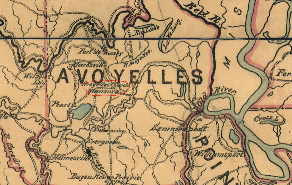
This 1864 map shows Mansura several miles away from the Red River...

... but this1865 map shows Mansura sitting prominently just above the confluence of the Red River with the Mississippi River, making it look as if Mansura was a river-town. If it was ever on the river, it wasn't for long.

Louis Herbert, a newspaper editor from Iberville Parish, explained that the only way to prevent washouts from flooding of the Avoyelles and Point Coupee parishes was to close off the Atchafalaya River and divert the Red River away from the Old River. This apparently sparked a major outcry from concerned citizens, and he tried to explain that he wasn't necessarily in favor; but, eventually, the army corps of engineers put this plan to work. The Red and Atchafalaya rivers were diverted into a large wetland at Natchitoches Bayou (Red River State Wildlife Management Area, sometimes referred to as the "dismal swamp" on maps) to enter the Mississippi in a controlled state instead... this process took decades and is still ongoing.

Mansura became a land-bound town. Mail was delivered on horseback.

The USGS map from 1940 & 1954 shows that by the early 20th century, Mansura instead became a railroad town, with the Lousiana & Arkansas Railroad and Texas & Pacific Railway supporting its economy.

Today, Mansura is relatively high and dry, and so are the main bodies of water that used to surround it, Pearl Lake and the Old River.

Mansura is now best known for its tradition of cochon de lait - smoking a suckling pig - and pays homage to the craft in an annual festival (Louisiana Digital Library). Mansura is yet another fascinating Red River town.


Comments